Six Stunning Fall Hikes In the Seattle Area
With such close access to the surrounding mountains, beautiful displays of Fall foliage, and moderate temperatures, the Seattle area makes a great place to explore the outdoors come September and October. There are plenty of hikes for all ages and abilities - here are six to consider the next time you’re ready to hit the trail!
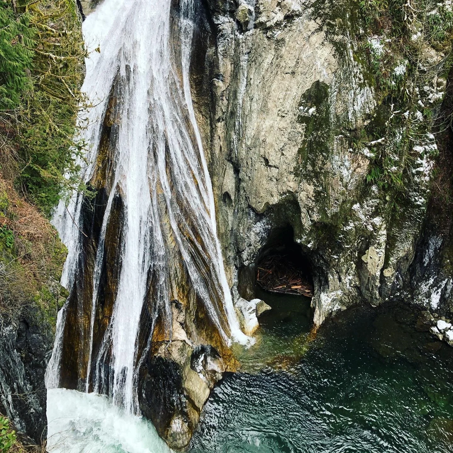
01 | Twin Falls (North Bend, WA)
Distance/Elevation: 2.6 Miles/500 ft Elevation Gain
Best For: A low elevation waterfall sighting
What it’s Like: Several peekaboo views and a main viewing platform offer multiple viewpoints of the serene set of “Twin Falls.” This hike offers a good workout, without being too strenuous.
Learn more at: https://www.wta.org/go-hiking/hikes/twin-falls-state-park
Quick tip: Many of the outdoor adventures listed won’t have cell service at various points of the drive, so save a screen shot of the driving instructions and map to your phone before you go!
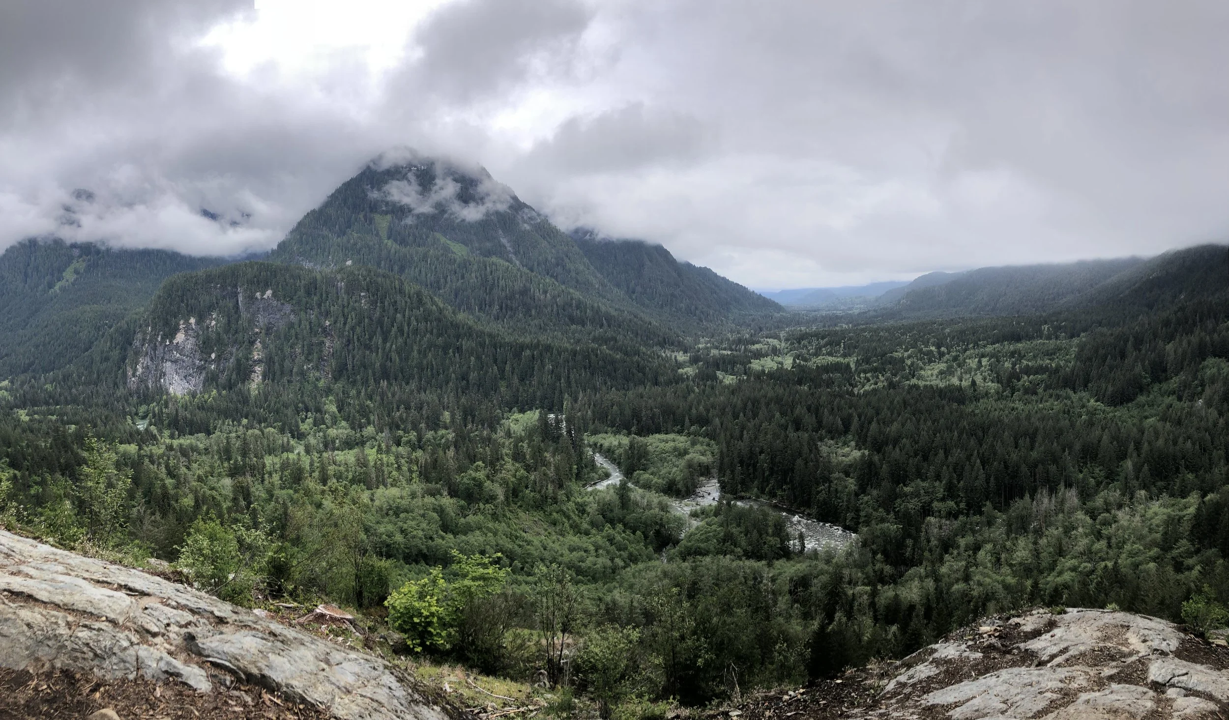
Valley views and Stegosaurus Butte from Garfield Ledges
02 | Garfield Ledges (North bend, WA)
Distance/Elevation: 2.2 Miles/230 ft. Elevation Gain
Best For: Bang for your buck
What it’s Like: If you’re looking for stunning views and far less crowds than many local favorites, head on out to the Garfield Ledges Recreation area. A meandering hike through the woods with minimal elevation gain will lead you to a steep overview of the valley floor below. Getting there will require navigating a road with a handful of pot holes, and the trail head can be found behind the bathroom facility at the Garfield Ledges Recreation Area.
Learn more at: https://www.wta.org/go-hiking/hikes/garfield-ledges
Quick tip: Be sure to check out what parking passes are required for any given hike, so you arrive at the trail head prepared!
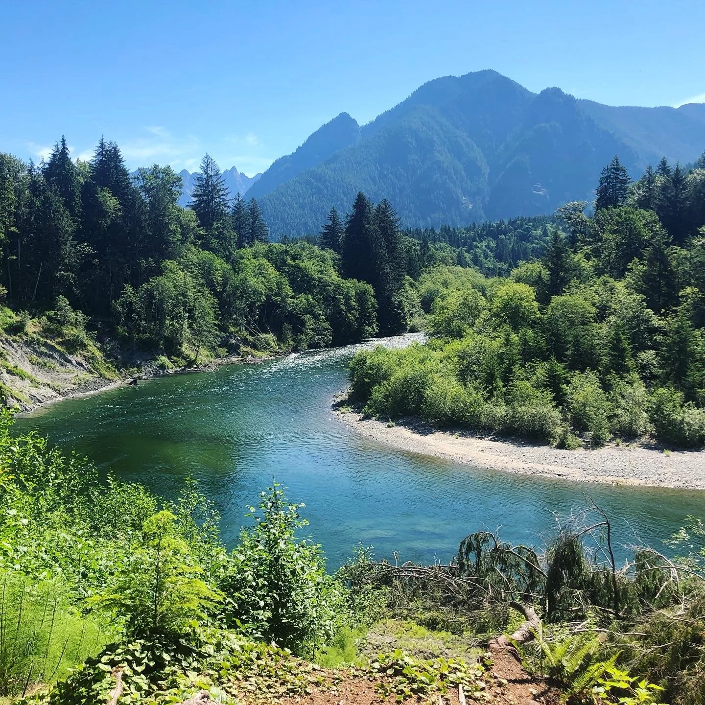
Oxbow Loop Trail Views
03 | Oxbow Loop Trail (North bend, WA)
Distance/Elevation: 1.8 Miles/56 ft. Elevation Gain
Best For: Young Kids
What it’s Like: As a low (pretty much no) elevation gain hike, the Oxbow Loop Trail is a family favorite for kids of all ages. As such it is accessible pretty much year-round, and offers gorgeous river, lake and mountain views all throughout the hike.
Learn more at: https://www.wta.org/go-hiking/hikes/oxbow-lake
Quick Tip: Always remember to pack The Ten Essentials for any outdoor adventure.
Views from the top of Poo Poo Point (where paragliders lift off!)
04 | Poo Poo Point/High School Trail (Issaquah, WA)
Distance/Elevation: 7.2 Miles/1748 ft. Elevation Gain
Best For: Longer distance and less trail-traffic
What it’s Like: Experienced hikers will enjoy an alternative route up to one of the most popular lookouts on Seattle’s Eastside. Poo Poo Point is typically accessed via the Chirico Trail, which is about half the distance and a (very) high traffic trail. For far less people, and a little more mileage, head to the Poo Poo Point/High School Trailhead behind Issaquah High School.
Learn more at: https://www.wta.org/go-hiking/hikes/poo-poo-point
Quick Tip: Before heading out let family or friends know where you’re going.
Cascade Mountain views from Gold Creek Pond Trail
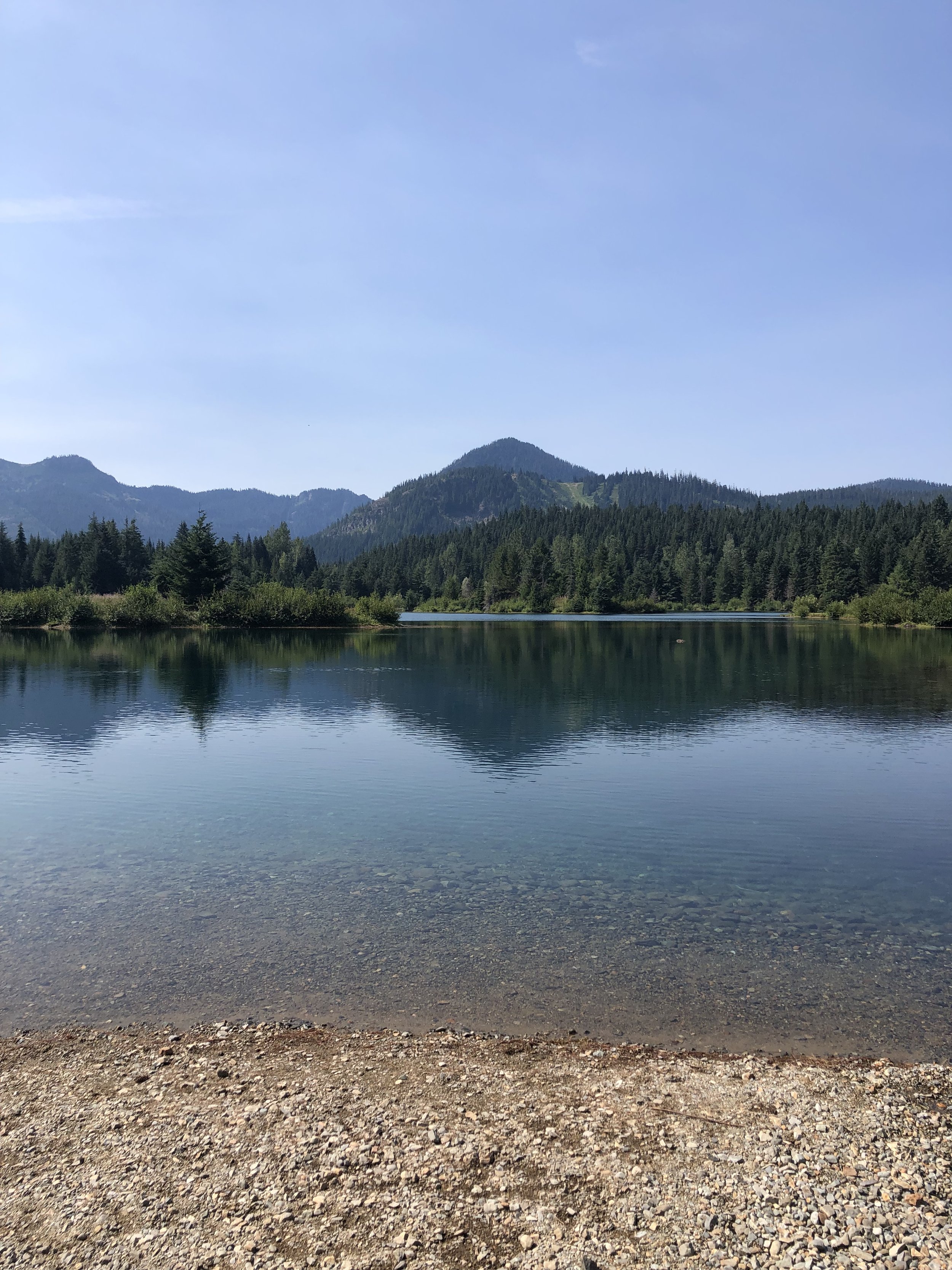
05 | Gold Creek Pond Trail (Snoqualmie Pass, wA)
Distance/Elevation: 1 Mile/10 ft. Elevation Gain
Best For: Mountain views and ADA accessible!
What it’s Like: At just over a mile roundtrip and virtually no elevation gain, Gold Creek Pond offers a loop trail with stunning views of the surrounding mountainsides, reflected in a tranquil pond. Much of the trail is paved, making several view points ADA accessible. Being at the Pass, snow can come early in the area so be sure to check the weather reports, especially in late Fall.
Learn more at: https://www.wta.org/go-hiking/hikes/gold-creek-pond
Quick Tip: Before heading out check the weather and recent trip/road repots.
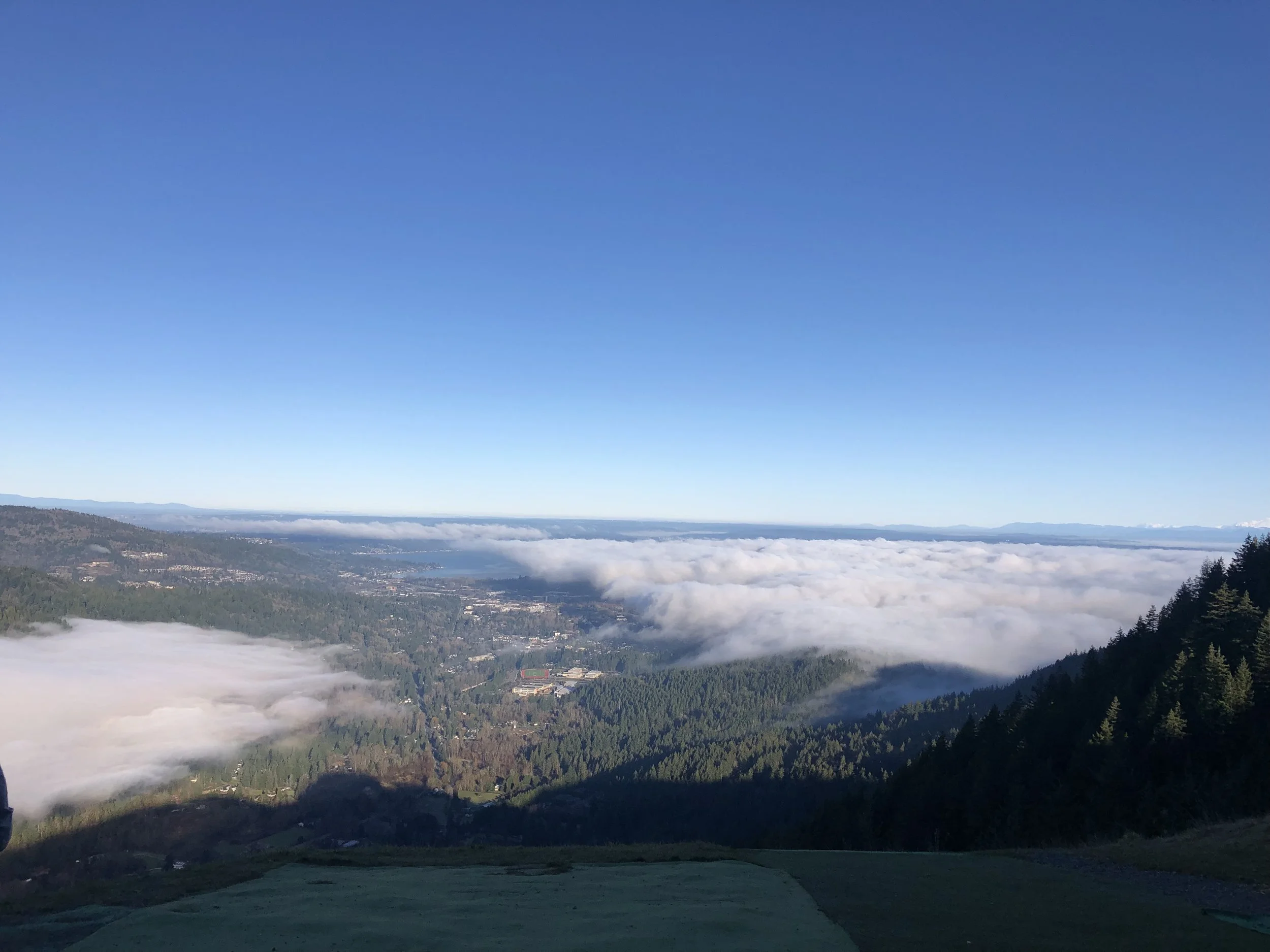
Views from the upper ledge above Rattlesnake Lake
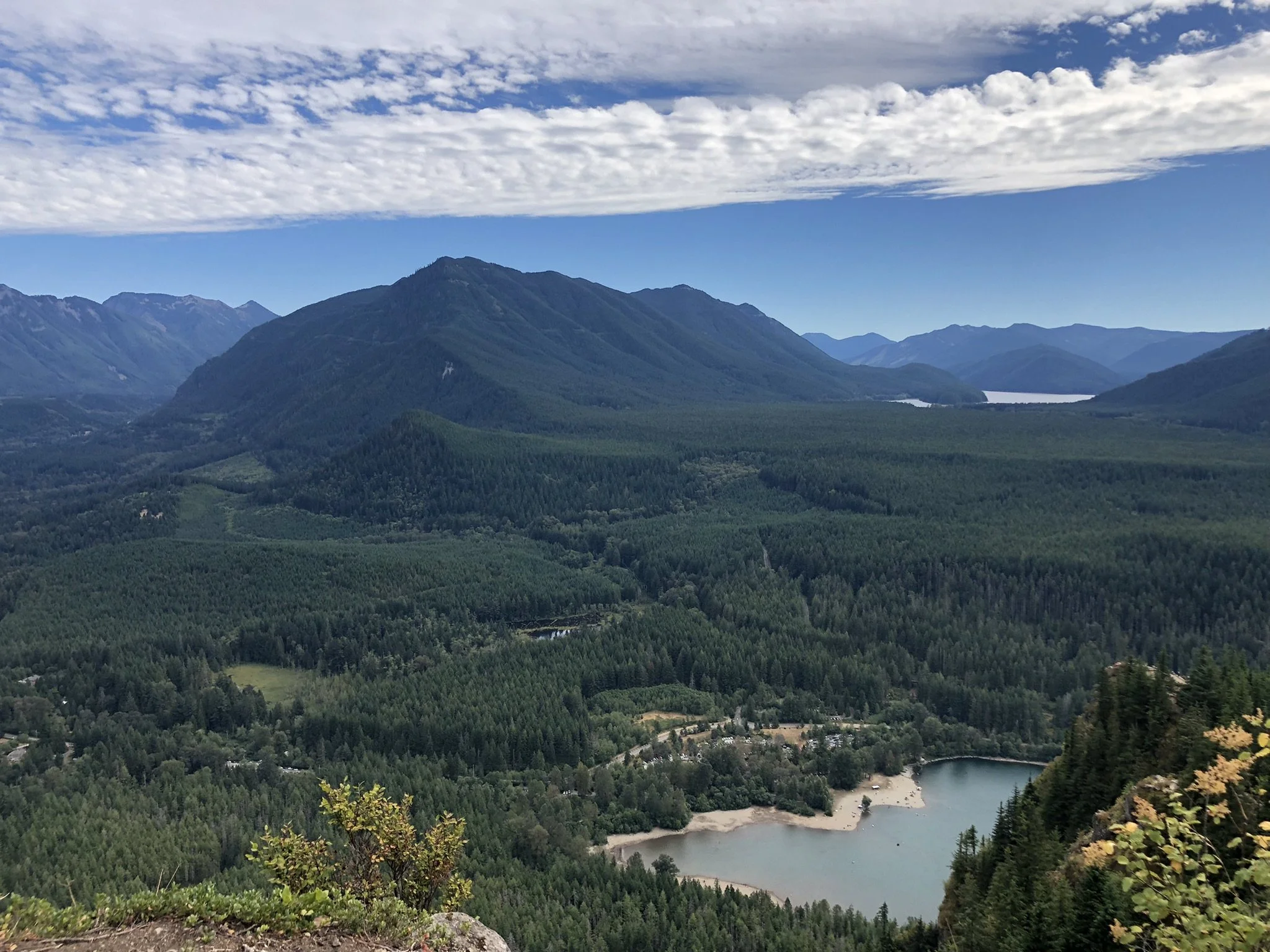
06 | Snoqualmie Point to Rattlesnake Lake (Snoqualmie/North Bend, WA
Distance/Elevation: 10.5 Miles/2520 ft. Elevation Gain
Best For: Experienced Hikers and Jaw-Dropping Views
What it’s Like: For the most ambitious of hikers, this unique point to point route takes you from Snoqualmie Point Park over Stan’s Overlook, Grand Prospect, and to the Rattlesnake Ledges. Starting about 4 miles in hikers will enjoy stunning views every couple of miles of North Bend, Mount Rainier, the Cascade Mountains, and Rattlesnake Lake Recreation Area. The route requires hiking with a buddy and shuttling a car to both the beginning and end point.
Learn more at: https://www.wta.org/go-hiking/hikes/rattlesnake-mountain
Quick Tip: Always take a photo of the map at a trail head before you hit the trail.